


It Starts With a Drop - a ByWater Newsletter
AI for flood prediction, thoughtful resilience, and a throwback to the saltwater wedge crisis.

Welcome to It Starts With a Drop!
ByWater Institute recently moved from Mailchimp to Substack.
New posts will automatically be delivered via email or the Substack app.
To create a Substack account, follow this link.
The 2023 Saltwater Wedge Crisis Was a Mess. We Talked About it.
(3 minute read)
Remember the Panic?
In late 2023, headlines warned that salt water was creeping up the Mississippi River, threatening New Orleans’ drinking water. Panic swept social media, bottled water vanished from shelves, and residents braced for a crisis that—thanks to upstream rainfall—never fully arrived.
But what actually happened? And what did it reveal about the fragility of our water infrastructure, communication systems, and public trust?
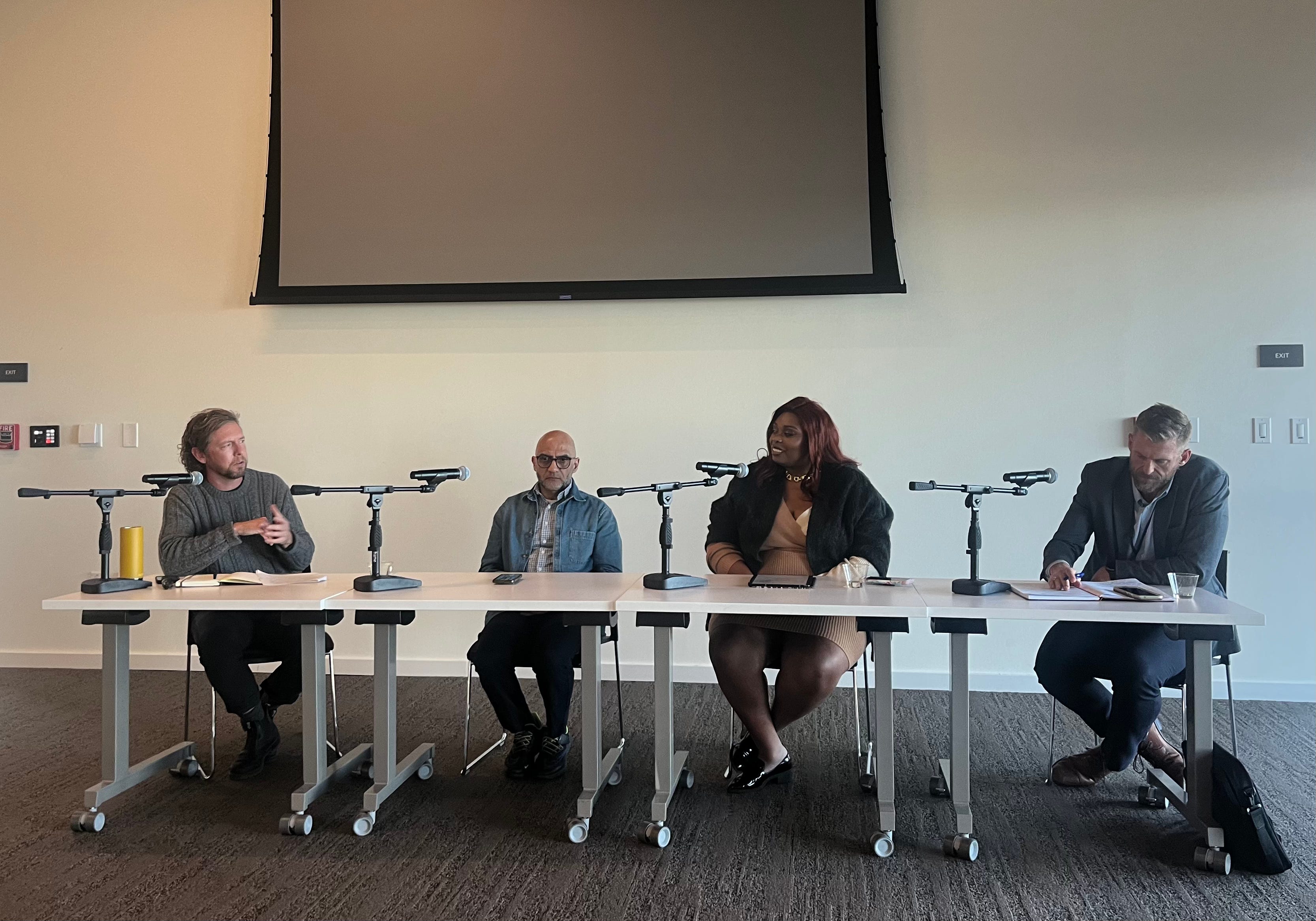
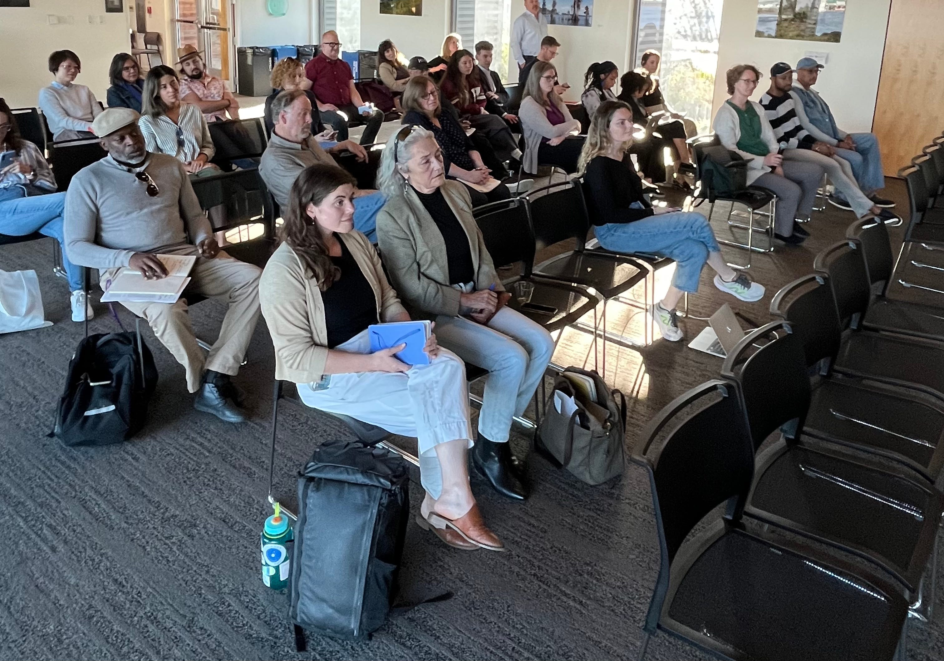
Those were the questions at the heart of “An Honest Conversation About Water Security,” the inaugural event in a new seminar series hosted by Tulane’s ByWater Institute. Held at the Tulane River and Coastal Center, the seminar brought together scientists, engineers, utility leaders, and community advocates to reflect on the saltwater wedge crisis and chart a more informed, collaborative path forward.
Setting the Stage
ByWater Director John Sabo explained the choice to hold a retrospective conversation after the emergency had passed. “Information wasn’t really flowing freely,” he said. “The solution space felt narrow—too focused on disaster response, not long-term adaptation.”
Moderated by ByWater Research Director Joshua Lewis, the event kicked off what will become an annual series on pressing climate issues affecting the Gulf South, with future topics to include insurance, energy, and more.
What Caused the Crisis?
While the saltwater intrusion was widely blamed on drought, Tulane river systems engineer Dr. Ehab Messelhe said the real culprit may lie in structural changes to the Mississippi River. Over the past decade, natural outlets like Mardi Gras Pass and Bohemia have grown significantly, siphoning off fresh water before it can reach the Gulf. That loss weakens the river’s ability to resist encroaching seawater.
Messelhe’s modeling suggests that temporarily plugging these outlets with sediment during droughts could be a simple, low-impact way to prevent future crises.
On the Ground: A Race Against Time
Meanwhile, Steve Nelson, General Superintendent of the Sewerage and Water Board, faced a different challenge: time. “We had 30 days to figure out what to do—and a day and a half to decide,” he said.
Reverse osmosis, bottled water, even shipping water in by barge were all floated. None were feasible at the scale required. Instead, the utility began planning a backup pipeline to bring in fresh water from upstream—and started testing how salt water might corrode the city’s aging network of 30,000–50,000 lead service lines.
“Salt itself isn’t the biggest health risk,” Nelson explained. “It’s how it might interact with our infrastructure. A change in chemistry could release lead into the system.” That insight has since driven a broader lead pipe replacement initiative now underway across the city.
When Fear Spreads Faster Than Facts
As salt crept upriver, anxiety flooded social media. “People weren’t just worried—they were scared,” said Jessica Dandridge, director of the Water Collaborative of Greater New Orleans.
Her team jumped into action, translating technical updates into plain language and simple visuals for the public. Their goal wasn’t to downplay the risk but to cut through the confusion and communicate clearly.
Dandridge argued that future water crises won’t just require better infrastructure—they’ll require better messaging. “People need facts,” she said, “but they also need empathy.”
Why It Matters
The saltwater wedge was more than a crisis averted—it was a stress test. For New Orleans, it exposed structural weaknesses, communication gaps, and the high stakes of inaction. But the ByWater seminar also spotlighted something else: the power of transparent, collaborative dialogue to move the needle on resilience.
This was just the first in ByWater’s new series of “honest conversations,” but it set a high bar. Whether you're a scientist, policymaker, or simply someone who cares about turning on the tap, the next seminar is worth showing up for.
The Future of Floods, Forecasted by AI
How is modern environmental science and machine learning reshaping how we interact with water? Ibrahim Demir has a few ideas. (5 minute read)
During a major flood event in Iowa, local TV stations ditched the stock graphics of rising water levels. Instead, they were using a platform designed by Ibrahim Demir and his research team to track the situation in real time. Their cutting-edge system was used by journalists live on air and their viewers back home simultaneously. Thousands of people were logging in for forecasts and damage estimates.
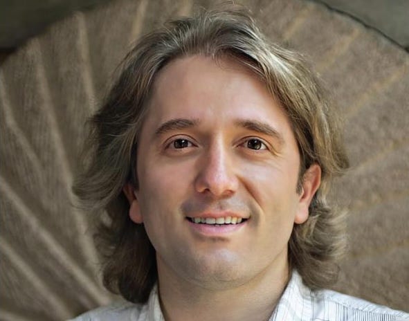
Now, at Tulane University, Ibrahim Demir is bringing that real-world orientation to Louisiana. As the Michael A Fitts Presidential Chair in Environmental Informatics and Artificial Intelligence at the ByWater Institute and a Professor in the Department of River-Coastal Science and Engineering, he’s focused on developing AI-powered tools that help researchers, agencies, and communities prepare for the water-related challenges of a changing climate.
His journey to Tulane winds through Asia, Europe, and North America. He was born and raised in Gaziantep, a city in southeastern Turkey with over 2,000 years of history—once part of ancient Anatolia and home to Roman mosaics, stone fortresses, and the famed pistachio trade. He studied in Istanbul before moving to the U.S., where he has lived and worked for the past 20 years.
Originally trained in computational chemistry, Ibrahim shifted toward environmental science during graduate school, seeking a field where his technical skills could have a more immediate, practical impact.
“Half the environmental challenges I was seeing were chemistry problems,” he said. “But I also wanted to bring in informatics, machine learning, and data-driven tools.”
Making Sense of Water, One Algorithm at a Time
Ibrahim works at the intersection of hydrology and informatics. The field of environmental informatics first emerged in the 1990s as environmental data became too vast and complex for traditional methods. It aimed to bridge the growing divide between natural science and computational tools. Out of this grew hydroinformatics, a more specialized branch focused entirely on water systems—rivers, floods, groundwater, infrastructure—where modeling and real-time data could support everything from climate resilience to disaster response.
What makes hydroinformatics so powerful is its ability to absorb sprawling datasets—stream gauge readings, rainfall, soil saturation, elevation, infrastructure—and use machine learning to detect patterns or forecast risks. The tools are used to inform everything from long-term climate adaptation plans to real-time emergency response systems.
“Most of the large-scale environmental problems we face—flooding, drought, water quality—depend heavily on data,” he said. “You need monitoring, prediction, analysis, and communication. That’s where computational tools come in.”
Ibrahim has spent much of his career turning those tools into public systems. At the University of Iowa, he led the development of the Iowa Flood Information System, which remains widely used by residents, emergency responders, and government agencies.
“Some of those platforms have hundreds of thousands of users. During major events, they might see tens of thousands logging in at once,” Ibrahim said.
And as AI technologies have evolved, so have the tools Ibrahim and his team use. In recent years, they’ve adopted deep learning methods originally developed for other fields—like LSTM (long short-term memory) networks, which were first designed to process language. These models are especially good at understanding sequences and patterns over time. Ibrahim explains that water systems behave in similar ways to a language: streamflow, rainfall, and river levels respond to each other in complex, time-dependent ways that LSTM models are well-suited to handle. More recently, his team has begun experimenting with transformer architectures, the same underlying technology powering modern AI chatbots.
Training AI to Think Like a Hydrologist
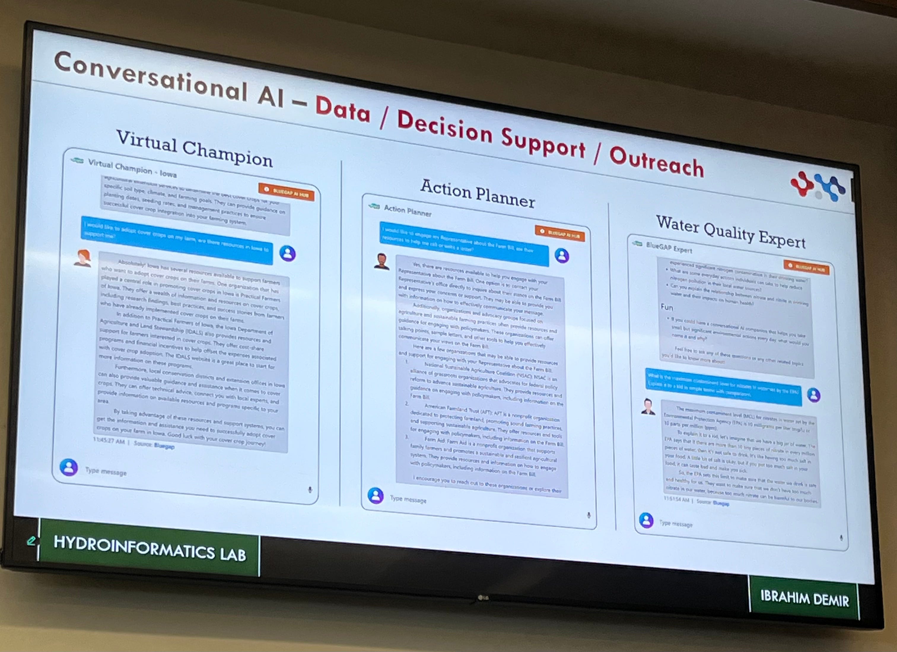
While large language models like ChatGPT have captured public attention, Ibrahim is working on something more domain-specific: custom-built AI systems trained to understand the science of water. Instead of scraping the internet for general knowledge, his team is feeding their models scientific literature, textbooks, and hydrological data—training AI agents to act as expert-level assistants for researchers, students, and emergency managers.
“We’re not starting from scratch,” he said. “We take existing, open-source language models and fine-tune them with accurate, discipline-specific content. Think of it like taking a bright undergraduate and giving them graduate-level training in hydrology.”
The vision is to create what Ibrahim calls a “co-scientist”—a digital assistant that could answer technical questions, analyze data, generate instructional material, and even help write research papers or grant proposals. In the classroom, these agents might serve as virtual tutors or teaching assistants. In the field, they could assist with real-time analysis and decision-making during floods or droughts.
Water Challenges in Louisiana
Louisiana is no stranger to the dangers of water. In conversations with state officials, Ibrahim quickly identified a major gap: the state lacks a unified data infrastructure for water-related issues. Different agencies collect and use data independently, leading to fragmentation and inefficiencies.
“One of the critical needs is a statewide cyberinfrastructure for water,” he said. “We’ve built systems like this in other states. Once you have the right foundation in place you can build new systems quickly and cost-effectively.”
Ibrahim sees an opportunity for Tulane and the ByWater Institute to help lead that transformation, working alongside agencies and communities to modernize how Louisiana manages its most vital and volatile resource.
“This kind of work is inherently interdisciplinary. We need computer scientists, engineers, environmental scientists—and increasingly, communicators and educators,” he said.
A Vision for the Future of Scientific Research
Ibrahim sees AI playing an increasingly prominent role in how science gets done—especially in data-heavy fields like hydrology. He envisions a future where researchers have access to advanced AI assistants that support every step of the scientific process, from literature reviews to data analysis to manuscript writing.
“The goal is to create intelligent agents that don’t just automate tasks, but enhance creativity and insight,” he said.
He’s well aware of the concerns surrounding AI in education—especially the fear that it might replace professors or teaching assistants. But for now, he sees the technology as an augmenting force, not a disruptive one.
“I was teaching a class with 500 students,” he said. “We had four teaching assistants. That’s not enough. If an AI can answer the routine questions, it frees us up to focus on mentoring, critical thinking, and creativity. That’s where humans are still essential.”
Why Tulane?
Tulane’s size, flexibility, and location make it uniquely suited to the kind of work Ibrahim is doing. At larger public universities, he said, it can be harder to pivot quickly as technologies evolve. But at Tulane and ByWater Institute, he’s found leadership that is open to bold ideas and willing to invest in emerging fields like AI and environmental informatics.
“Louisiana is a living laboratory for water research,” he said. “And Tulane has the potential to be a national leader—not just in science, but in how we apply science to protect communities.”
Ibrahim’s work is driven by a belief that technology should serve people, not the other way around. Whether he’s building a forecasting model, training an AI assistant, or designing a holographic flood map, the goal is the same: to give people the tools they need to understand, adapt to, and live with water.
“Water will always find a way,” he said. “We can’t control that—but we can get smarter about how we respond.”
Laying the Groundwork for a New Kind of Resilience
Six months into a five-year NOAA-funded project, Simone Domingue and her collaborators are mapping not just risks but relationships. (3 minute read)

In a meeting room in Lafayette, Louisiana, community leaders and researchers leaned over large, printed maps, discussing the places they knew well—and the ones they didn’t. It wasn’t a technical mapping exercise. It was a conversation starter: Who do we already have at the table? Who’s missing? And how do we make sure they’re included?
“We printed out maps and looked at where there were strong connections—and where there were gaps,” said Simone Domingue, a staff researcher at Tulane’s ByWater Institute and the lead investigator on a major NOAA-funded climate resilience project. “We’re asking: who’s not in the room yet, and how can we connect with them?”
That kind of work—face-to-face, relationship-driven, and often unglamorous—is the heart of the first year of the five-year effort. Announced in the fall of 2023, the project received nearly $2 million from NOAA as part of the federal Climate Resilience Regional Challenge. Its goal: to help communities in Southwest Louisiana and Central Acadiana become more resilient to climate-driven disasters by focusing not only on physical vulnerabilities but also on social, cultural, and institutional ones.
“There won’t be major developments yet,” Domingue said. “It’s a lot of groundwork right now—but we’re already learning what’s possible and what’s in the way.”
Navigating Complexity, Close to Home
The project’s terrain is far from simple. Domingue and her team are working across a broad geography—multiple parishes, tribal communities, rural towns, and watershed districts—each with its language, history, and relationship to risk.
“Even I, being from Lafayette and familiar with Cajun French, didn’t realize how much the language and culture vary across small geographic areas,” she said. “That complexity is part of what makes the work rewarding, but it also makes it challenging.”
In rural areas, where populations are sparse and infrastructure is limited, even reaching residents can be difficult. And with so many players involved—local governments, nonprofits, tribal entities, mutual aid groups—there’s no one-size-fits-all solution. The project team is tasked with making the pieces of this regional puzzle fit, all while remaining sensitive to the distinct identities and priorities of the communities they’re engaging.
They’ve also had to balance logistical realities with the need for meaningful dialogue. While virtual meetings are necessary, Domingue emphasized that something essential gets lost on Zoom.
“There are certain kinds of conversations—about people’s lived experiences, their fears, their hopes for the future—that just don’t translate as well over a screen,” Simone said.
The Role of Culture and Creativity
To bridge those gaps, the project is leaning into tools that are sometimes overlooked in disaster resilience planning: art, storytelling, and cultural memory.
“Arts and culture can help express things that are intangible—people’s connection to place, their vision for the future,” Domingue said. “They also open people up to new ideas, to new ways of thinking.”
By working with artists, cultural institutions, and community historians, the team hopes to foster trust, build understanding, and capture the emotional and cultural dimensions of resilience that don’t always show up in technical plans.
Barriers and Breakthroughs
For Domingue, a sociologist by training, the challenges of resilience planning are as much about systems as they are about people. Funding shortfalls, jurisdictional fragmentation, and policy hurdles all constrain what communities can do—even when they know what they need.
“There are funding limitations, political challenges, legal constraints—all of that makes it harder for communities to act at scale. There are also real knowledge gaps. People don’t always know what to advocate for because they’ve never been given access to the full picture,” Simone said.
In a region shaped by centuries of cultural and environmental change, building consensus can be tough. But Simone is hopeful that the project’s community-first approach, especially its emphasis on co-production, can help shift the dynamic.
“We’re trying to build something holistic,” she said. “Not just another technical plan, but a process that honors the different ways people understand resilience.”
Looking Ahead
With foundational work underway, the team is beginning to map out what comes next. Additional oral history work, modeling, and policy analysis are in the pipeline, alongside ongoing efforts to ensure that local knowledge continues to inform each step.
“The scale is big, and there are a lot of puzzle pieces,” Domingue said. “But that’s what makes it exciting. Everyone we’re working with sees the potential for something truly impactful.”